Most of a day
Reserve a 4 night New River Gorge trip from Cincinnati
257.7 measured miles from Fountain Square, 5.53 hours at the wheel, four nights at the far end of it. That comes to 1.38 hours of road for every night booked, which puts this entry on the third step of four: the road is most of a day.
Nothing is held here until the office has written back and you have said yes to what it wrote. No part of a stay is ever paid for through these pages.
- Road from Fountain Square
- 257.7 miles
- Hours at the wheel
- 5.53
- Nights the office books
- 4
- Hours of road per night
- 1.38
- From
- $820 per person
Hours and miles are measured along the road from Fountain Square, not drawn straight on a map, and they assume clear traffic. Your own run will differ with weather, roadworks and the hour you leave.
The road is measured before the room
Anyone who wants to reserve a 4 night New River Gorge trip from Cincinnati is agreeing to 257.7 miles of road in each direction and 5.53 hours at the wheel. Go Air Travels measures that distance from Fountain Square and prints it here, before the booking rather than after it. The gorge does not come any closer because a description is warm about it.
Spread across the four nights the office holds, the drive works out at 1.38 hours of road for every night spent there. That is the third step of four. The road is most of a day, which is an honest way of saying it is not a morning errand and it is not a two day haul either. One day goes out, one day comes back, and the four nights in between are what make the arithmetic work.
The measured time runs longer than the mileage on its own would suggest. A good part of the route is two lane highway along the Ohio River, with towns, lights and river traffic beside it, and the last stretch climbs onto the plateau. The office quotes the measured figure, not the optimistic one.
What stands in the gorge
The New River runs in a trench cut through sandstone and shale on the western edge of the Appalachian Plateau. The rim carries hardwood forest and small towns; the river itself sits far below and stays out of sight from most of the roads. That is the first thing to understand about the place. Almost nothing here is visible from a parking lot, and the gorge takes a day or two to read properly.
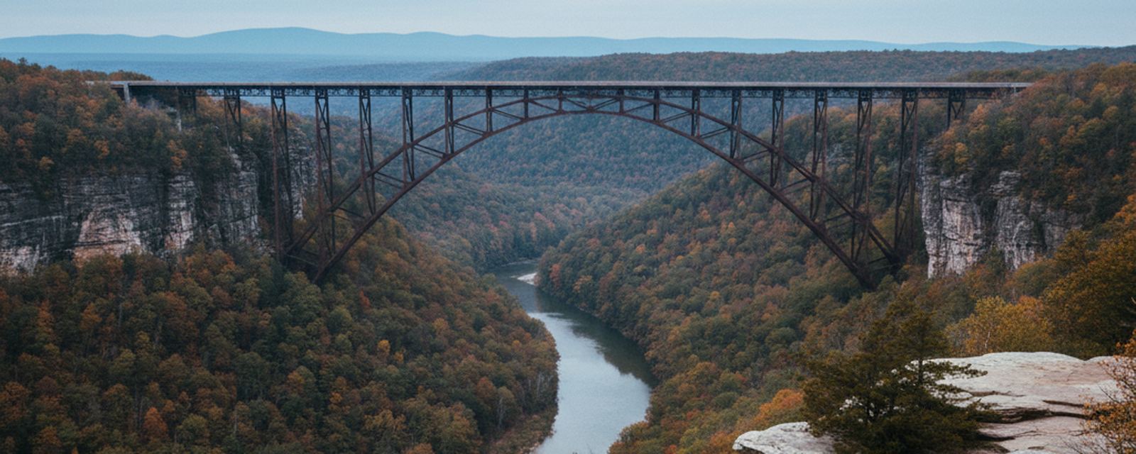
The steel arch carries US 19 across the gap at 876 feet above the water. It opened in 1977 and replaced a slow descent on a narrow road down to the river and back up the far side. That old road, Fayette Station Road, is still in use, one lane and switchbacked, and it remains the way to stand at water level under the arch without walking in.
Below the rim the walls are climbed rock, and the ledges carry names older than the park. Coal came out of this gorge for decades and the mine towns went quiet when it stopped. Foundations, tipples, coke ovens and rail beds are still standing in the trees, which is why a walk here reads as much like a ruin as a forest.
Four nights, and what the four days hold
Four nights gives four working days, and the gorge fills them without strain. The rim trails are the obvious start. Endless Wall runs along the lip of the cliff line with the drop opening through the trees, and Long Point ends on a bare rock spine with the arch across the view. Both are short enough that one day can take in the two of them and still leave an afternoon for the overlooks at Grandview, upriver toward Beckley.
A second day belongs below the rim. The Kaymoor Miners Trail drops off the plateau by a long flight of wooden steps to the bench where the mine and its town stood. Nuttallburg, reached by a slow gravel road down Keeneys Creek, holds a standing conveyor running up the hillside and a row of coke ovens in the woods. Thurmond, on the river itself, was a railroad town; a depot and a short line of buildings still face the tracks, and freight still comes through.
The remaining days go wider. Sandstone Falls sits downstream of Hinton, where the river spreads across its whole width over a ledge and a boardwalk runs out to it. Babcock State Park keeps a rebuilt grist mill on Glade Creek. Whitewater runs through the gorge for most of the season, and rafting is arranged on the ground by the traveler, because Go Air Travels books nothing that floats.
What the drive shows on the way east
The route leaves the city on the Ohio side and follows the river for a long stretch, two lanes for much of it, water on one hand and hills crowding the road on the other. Barge tows work the channel. The river towns come one after another, each behind its floodwall, and Portsmouth keeps a long painted wall facing the water.
At Huntington the road joins the interstate and turns up the Kanawha valley past Charleston, where the bottom land carries chemical plants and rail yards with the hills closed in over them. After Charleston the road climbs. The grade is long, and the cuts through it show the rock in bands, the same rock the gorge is cut into further on.
The last part runs on US 19, and the bridge arrives without much warning. Traffic crosses it at speed and most drivers see very little of the gorge from the deck. The view is from the overlook on the north rim, a short walk down from the visitor parking, and it is worth the stop before turning off toward the lodging.
Where Go Air Travels stops
This is a reservations office and its range is narrow on purpose. It measures a road from Fountain Square, it books a bed at the other end of it, and it writes both down in the same document. It puts nobody on anything that moves: no seats, no rail, no coach, no boat, no transfer from one place to another. The traveler's own car does the moving, and the 257.7 miles are the reason the office measured before it offered.
Insurance, visas and passports sit outside the office altogether. It sells none of them, arranges none of them and offers no opinion on any of them, and it will say so again if asked. Nor does it name the lodging on this page. The specific property, its rooms and its terms go into the written offer that follows a request.
Prices start from $820 per person for the four nights. That figure covers what is listed below and nothing beyond it, and the final number is confirmed in writing when the dates are held.
What the figure holds
- Four nights of lodging within reach of the gorge rim, held in the traveler's own name.
- A written road sheet for the 257.7 miles: the turns, the river towns and the places where the road changes character.
- One parking space at the lodging for the length of the stay.
- A day by day outline for the four days, with trailheads named and their road approaches described.
- Written confirmation of every reservation before the drive.
- One named contact at the office for changes to dates or to the number of rooms.
What it leaves to you
- Transport of every kind. The traveler covers the 257.7 miles in a private car.
- Fuel, tolls and anything the car needs on the way.
- Rafting, climbing instruction and any other guided day on the river or the rock.
- Meals of any kind.
- Insurance, visas and passports. The office sells none of them, arranges none of them and offers no opinion on any of them.
The office adds no booking fee of its own. What you pay is what each supplier charges, and the written offer shows each line separately.
When this one is worth the road
Two parts of the year carry this drive best. From late April into June the water is high, rhododendron comes in on the lower slopes and the rim trails stay quiet on weekdays. From mid September into late October the hardwoods turn and the river runs low and clear, though weekends fill up across the whole gorge. One date is worth planning around: on the third Saturday in October the bridge closes to vehicles for the day and traffic goes the long way around through Fayetteville, which adds to a drive that is already most of a day. July and August are humid at river level and several degrees cooler on the rim. January and February are quiet, and the steep trails below the rim ice over.
Does Go Air Travels book the journey as well as the nights?
No. The office books the four nights and writes out the road. Nothing that moves is reserved here, and the 257.7 miles are covered by the traveler in a private car.
Why does this entry sit on the third step rather than higher?
Because 5.53 hours spread across four nights comes to 1.38 hours of driving for every night booked. The office sorts every entry by that quotient and prints it before the booking rather than after. The road here is most of a day, and four nights is what makes it worth doing.
Can the four nights be split between two places in the gorge?
Yes, and the office measures the road between them before it offers the split, the same way it measured the 257.7 miles from Fountain Square. If the second leg adds more driving than the second base is worth, it says so in the offer.
Nothing in this list moves you. Getting from one place to the next is outside what this office reserves and it signs nothing with any carrier; you take your own car, and the office books what waits at the far end.
Start with the number of nights
Tell the office how many nights you have. Everything else follows from that number, including whether the drive is worth making at all.